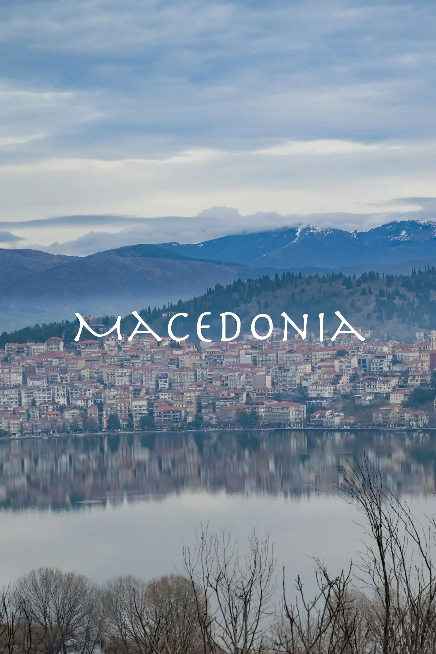
Macedonia
Macedonia (Μακεδονία) is a sprawling region of incredible beauty in northern Greece. Like most of the country, the area is a combination of mountain landscapes and fertile valleys, lush forests and flowing rivers, lakes and coastland marshes. I lived for many years in Eastern Macedonia and was able to travel quite extensively throughout the region, so this area holds a particularly special place in my heart.
Map created by SilentResident,Philly boy92, CC BY-SA 3.0, via Wikimedia Commons
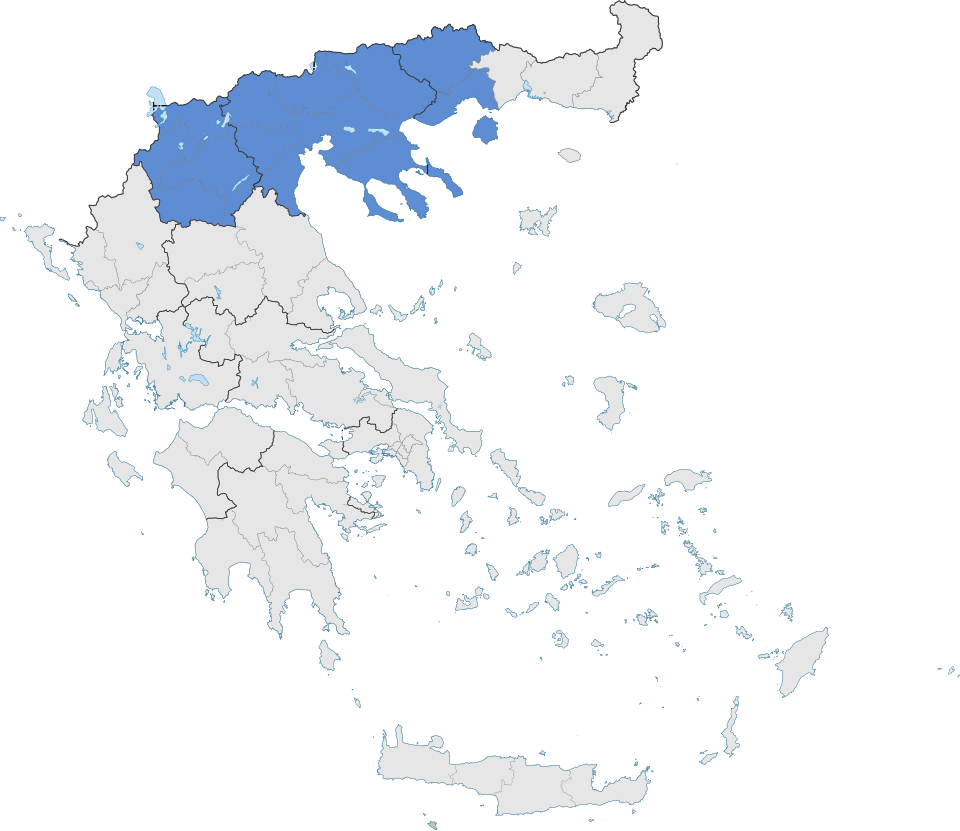
Macedonia is bordered to the west by the land region of Epirus, to the south by Thessaly and the Aegean Sea, to the east by Thrace, and to the north by the countries of Bulgaria, North Macedonia, and Albania.
In ancient times, the region was known as the kingdom of Macedon, with Philip II and Alexander the Great being two of its most well-known leaders. The god Dionysos spent considerable time in the region, as did the bard Orpheus, and so their mysteries have roots in the landscape.
Today the region is divided into Western Macedonia, Central Macedonia, and Eastern Macedonia, with the latter area often being grouped together with Thrace.
Western Macedonia
Click the play button to interact with the map
Western Macedonia is sparsely populated and is the only region of Greece without a coastline; its main cities cluster around important rivers and lakes.
In the northwest corner, at the crossroads of three countries (Greece, Albania, and North Macedonia), dwell the Prespa lakes—Big Prespa (Μεγάλη Πρέσπα) and Little Prespa (Μικρή Πρέσπα). The lakes offer a vital wetland and conservation area for hundreds of bird species, particularly the majestic Dalmation Pelican.
The Aliakmonas River (Αλιάκμονας) begins its flow in the Gramos Mountains (Γράμος) on the border with Albania in the west, and Mount Vourinos (Βούρινος) contributes its waters to the river as Aliakmonas continues to flow toward the Aegean sea.
The four largest cities of Western Macedonia include:
Grevena (Γρεβενά) on the banks of a tributary of the Aliakmonas River;
Kozani (Κοζάνη), about twenty kilometeres north of the artificial Lake Polyfyto (Λίμνη Πολυφύτου);
Florina (Φλώρινα), through which the Sakoulevas River (Σακουλέβας) flows;
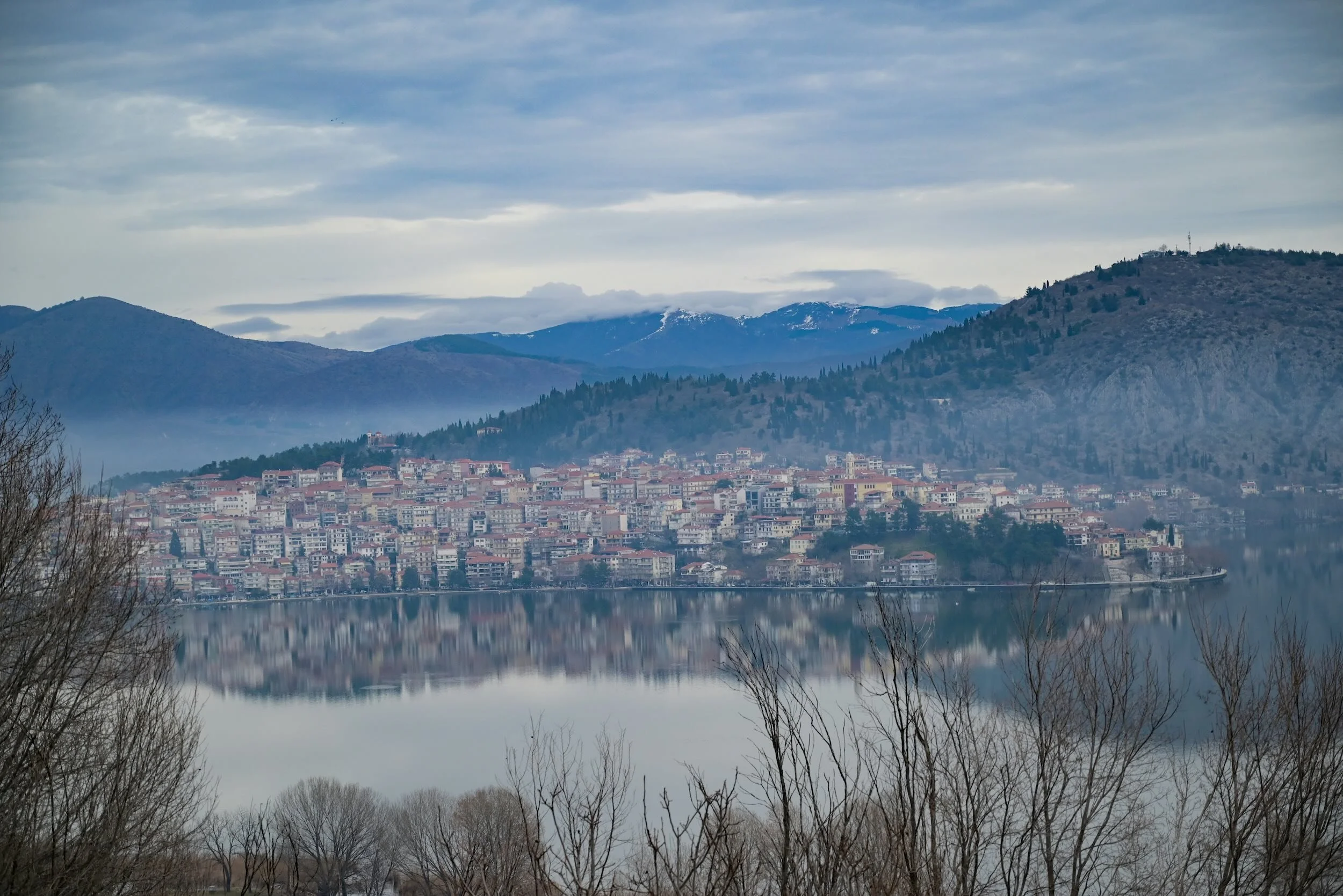
and, one of my favorite cities in all of Greece, Kastoria (Καστοριά), which is located on a peninsula in the beautiful Lake Orestiada (Λίμνη Ορεστιάδα).
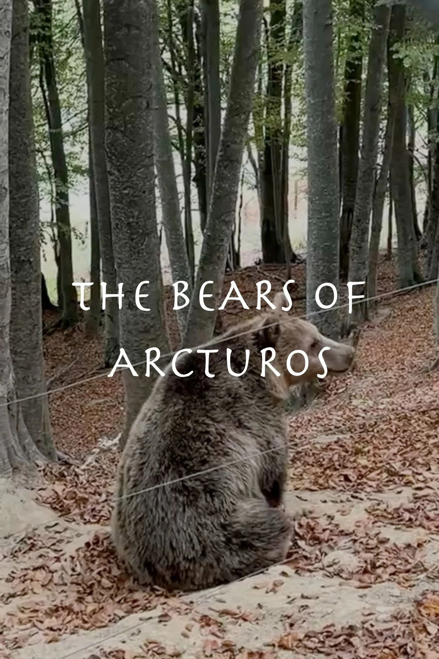
Close to Kastoria, on the south side of the lake, is a unique archaeoligcal site: the Prehistoric Settlement of Dispilio (Δισπηλιό). And traveling from Kastoria to Florina is the village of Nymfaio, host to the Wolf, Lynx, and Bear Sanctuary, a conservation non-profit effort run by Arcturos.
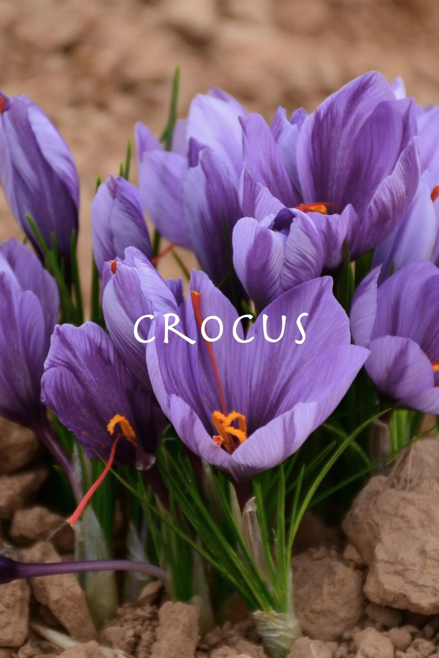
Western Macedonia is known throughout Greece for its Saffron (Krokos Kozanis), Florina Peppers (a non-native red pepper popular throughout the country), marble mining, and fur industry.
Western Macedonia also produces and provides the majority of Greece’s electrical power. The Ptolemaida Basin, just north of Kozani, is a coal-mining center and hosts several lignite-fired power stations, as well as numerous solar photovoltaic parks, which negatively impact the soil, water, and air quality of the basin.
Central Macedonia
Click the play button to interact with the map
Thermal springs, marshland sanctuaries, gushing waterfalls: Central Macedonia hosts some of my favorite spots in Greece.
Several of Greece’s tallest mountains lie within or on the area’s borders, including:
the Voras or Kaimaktsalan Mountains (Βόρας) on its border with North Macedonia;
the Pieria Mountains (Πιερία) and Mount Olympus (Όλυμπος) on the southern border with Thessaly, both of which were home to the Muses and the gods, and feature prominently in the Orphic mysteries (read more here);
and Mount Athos (Άγιον Όρος), the peak at the edge of the autonomous Eastern Orthodox monastic state.
In addition to snow-covered peaks, Central Macedonia possesses numerous coastal plains and fertile inland valleys, cultivated by humans with cereal crops, Olives, Grapes, and other important vegetables, herbs, and fruits of the Greek diet. Several vital waterways flow through and nourish the region, including the Aliakmonas (Αλιάκμονας), Axios (Αξιός), Gallikos (Γαλλικός), and the Mavroneri (Μαυρονέρι) rivers.
One of my favorite lakes in all of Greece exists in the north of this region: Lake Kerkini (Λίμνη Κερκίνη), an artificial lake created in the early 1900s that has become an important marshland ecosystem for birds, amphibians, and insects. Other important lakes in Central Macedonia include Lake Koroneia (Λίμνη Κορώνεια) and Lake Volvi (Λίμνη Βόλβη).
Home to Thessaloniki, the second largest city of the country, Central Macedonia is a cultural and economic hub for northern Greece. Other cities of the region include of Kilkis (Κιλκίς), Serres (Σέρρες), Veria (Βέροια), and Katerini (Κατερίνη), which acts as a base for accessing the Pieria and Olympos mountains.
Two towns worth noting are Edessa (Έδεσσα), built on a plateau with a stunning waterfall and views of the surrounding plains; and the Grape vineyards and traditional architecture of Naousa (Νάουσα), located at the base of the Vermio Mountains (Βέρμιο) which border Western Macedonia.
Near Naousa is the ancient site of Mieza (Μίεζα), where Alexander the Great was taught as a young boy by the philosopher Aristotle. And just north of Edessa are the Pozar Thermal Baths (Λουτρά Πόζαρ), a natural hot springs at the base of the Voras Mountains.
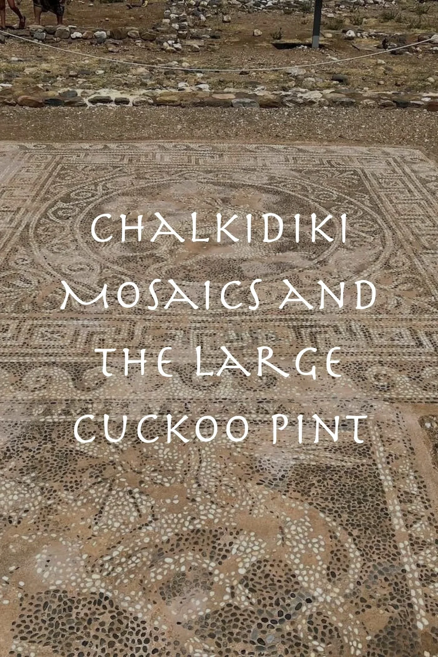
Another personal favorite is the peninsula of Chalkidiki (Χαλκιδική), which extends into the Aegean sea just east of Thessaloniki. Often described in English as a hand with three fingers, the Cholomondas Mountains (Χολομώντας) cover much of the central portion of the palm and the first two fingers are beautiful, forest-covered peninsulas with mountainous interiors and lowland beaches. The first finger, closest to the city of Thessaloniki, has more of a resort feel and is frequented by city-dwellers seeking a respite from the concrete. The second finger is slightly more wild and welcoming for campers, though the land is continuing to be developed for vacation homes. The third peninsula of Chalkidiki is the autonomous monastic state of the Eastern Orthodox Church and is forbidden to women; men interested in visiting must apply through the Church. (Read more about the palm of Chalkidiki here).


Eastern Macedonia
Click the play button to interact with the map
Eastern Macedonia, like Central Macedonia, is a study in contrasts between towering mountains and lowland, fertile plains. It is grouped with Thrace, not only for regional administrative purposes, but also because it shares similar characteristics with the geography of Thrace: both areas are defined by the southern foothills of the Rhodope Mountain range (Ροδόπη) and the Nestos River (Νέστος). (Read more about Thrace here).
The most striking mountain of Eastern Macedonia is Mount Paggaio (Παγγαίο), whose peak reaches 1956 meters and whose hills were sacred to the god Dionysos. Its lower elevations are covered in Oak, Chestnut, and Pine, and higher forests thick with Beech and Fir.
I lived for many years in a small village on the south side of Mount Paggaio, so this region of Greece is both familiar and dear to me. There are countless trails on all sides of the mountain with stunning views of the Rhodope mountains in the north and Mount Athos to the south. Unfortunately, the mountain has been mined extensively over the years, first for silver and gold in antiquity, and today for its stone; the southeast side of the mountain is extensively scarred by extraction.
Some of my favorite picturesque villages of Paggaio are Mesoropi (Μεσορόπη) and Moustheni (Μουσθένη) in the southwest, and Nikisiani (Νικήσιανη) and Palaiochori (Παλαιοχώρι) in the northeast; they offer local food, unique architecture, and access to trails on the mountain. For a special meal at a local tavern beneath thousands-of-years-old Plane trees, I suggest Dio Vrises (Δυο Βρύσες) near the village of Kipia (Κηπιά).
South of Paggaio is the small mountain chain of Symbolo (Σύμβολο), whose valleys host Grape vineyards and small farms, before giving way to coastal towns with views of Chalkidiki and the island of Thassos. The beaches along that coast are some of my favorite as they are less popular with tourists, especially the nudist beach.
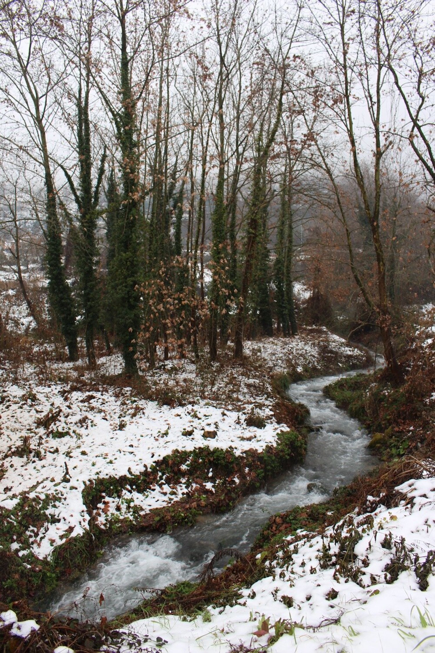
The coastal city of Kavala is built amphitheatrically on the side of a mountain, with the Old Town on a hill overlooking the port. Ruins of an old Roman aquaaduct still stand in the city, and the old road connects the north side of the city to a trail to Palea Kavala (Παλαιά Καβάλα). Near there is a peaceful trail through a narrow river valley lush with Plane trees, an old watermill, and a waterfall just before the trail ends in an old quarry.
North of Mount Paggaio and Kavala is a fertile plain stretching to the borders of Bulgaria. The ancient city of Philippi (Φίλιπποι), including its acropolis and stunning theater, are open to visitors and host concerts in the summer. Continuing north is the city of Drama (Δράμα) at the foot of Mount Falakro (Φαλακρό)on the Bulgarian border, and further northwest is the unique Aggitis River Cave (Αγγίτης).
Heading east from Drama, one of my favorite areas of the region is on the Thrakian border, near Paranesti (Παρανέστι), where the heritage seed group, Peliti (Πελίτι), has its roots, and where walking trails start beside the Nestos River (Νέστος) and wind into forests lush with plantlife. Following the Nestos river south toward the delta are stunning viewpoints and further access trails to the forest.
The island of Thasos (Θάσος) is also included in the region of Eastern Macedonia, reachable by ferry from Keramoti (Κεραμωτή) and, less frequently, from Kavala. It is a lush island, less than 10 kilometers off the coast. According to myth, it was the home of Staphylos (Στάφυλος), one of Dionysos’ sons, and therefore the wine from Thasos is reported to be particularly exquisite.


.svg)