Peloponnese
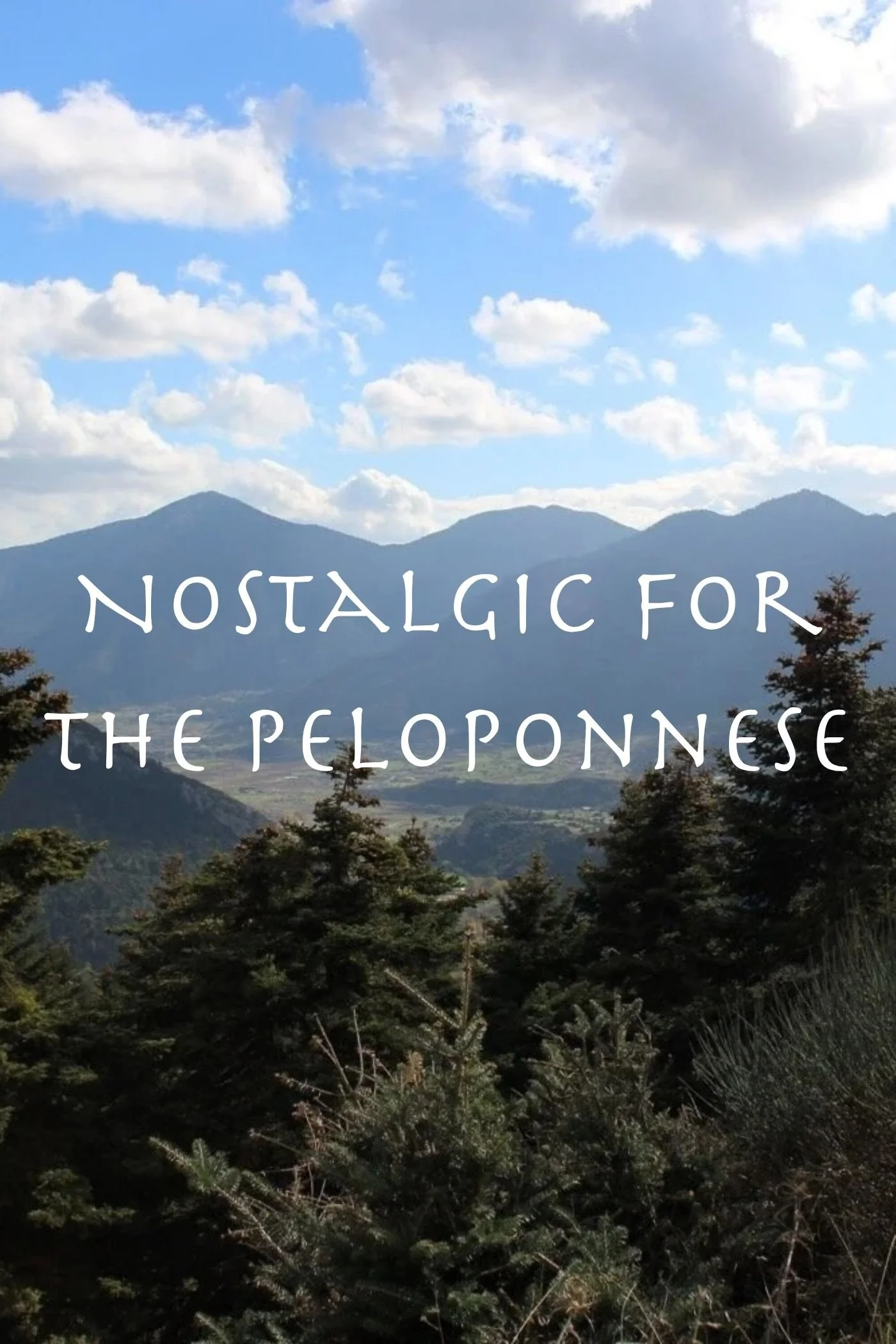
The Peloponnese (Πελοπόννησος) is one of the most archaeologically significant regions of Greece, home to the sacred and ancient sites of Epidaurus, Corinth, Olympia, Mycenae, Messini, Sparta, and more. Beyond its classical heritage, there are also many exquisite Byzantine centers to explore in the region, such as Monemvasia, Mystras, and Nafplio, not to mention its outstanding natural beauty and awe-inspiring horizons of verdant mountains and vibrant, blue waters.
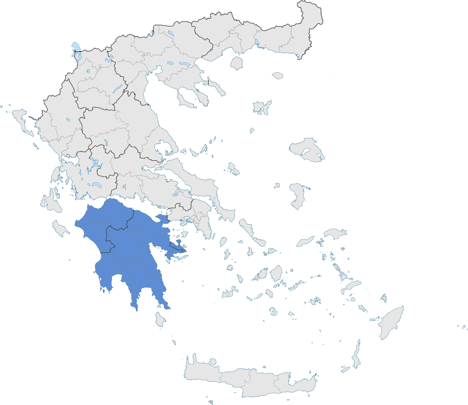
Map created by SilentResident,Philly boy92, CC BY-SA 3.0, via Wikimedia Commons
The Peloponnese is the southernmost peninsula of mainland Greece, a mountainous region linked to the rest of the country only by a narrow strip of land called the Isthmus of Corinth. Due to this unique geography, to reach the Peloponnese by foot, bike, or car, you must enter the peninsula via the isthmus in the east or cross over the Corinthian Sea via the Rio–Antirrio Bridge near Patras in the west.
Just before the turn of the 20th century, the Corinth Canal was dug through the region’s isthmus, creating a water bridge between the Corinthian Sea in the north and the Saronic Gulf in the east. To the west of the Peloponnese is the Ioanian sea. To the south is the Mediterranean sea and the island of Kythira (Κύθηρα).
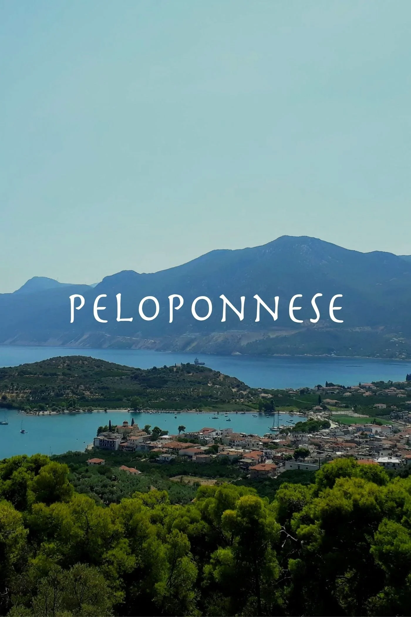
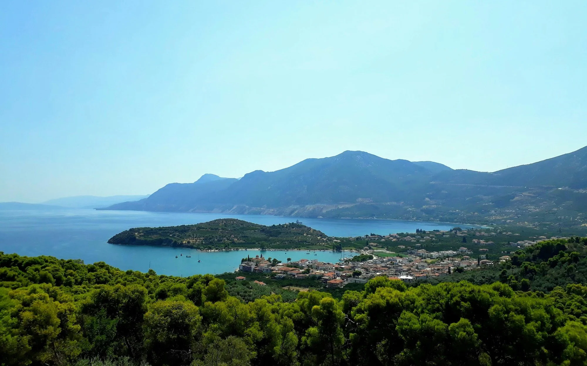
The Peloponnese has four peninsulas: the closest to Athens is known as the Argolid (Αργολίδα); the three southern fingers are Messinia (Μεσσηνία) to the west, Mani (Μάνη) in the center, and Cape Malias (Καβομαλιάς) to the east.
Click the play button to interact with the map
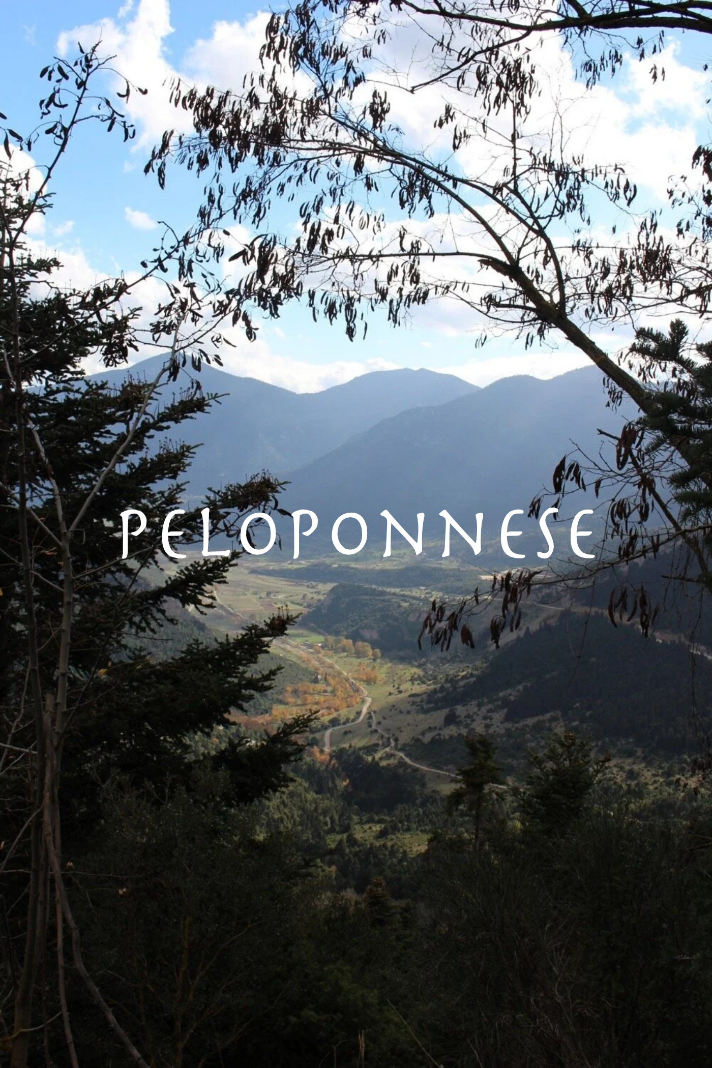
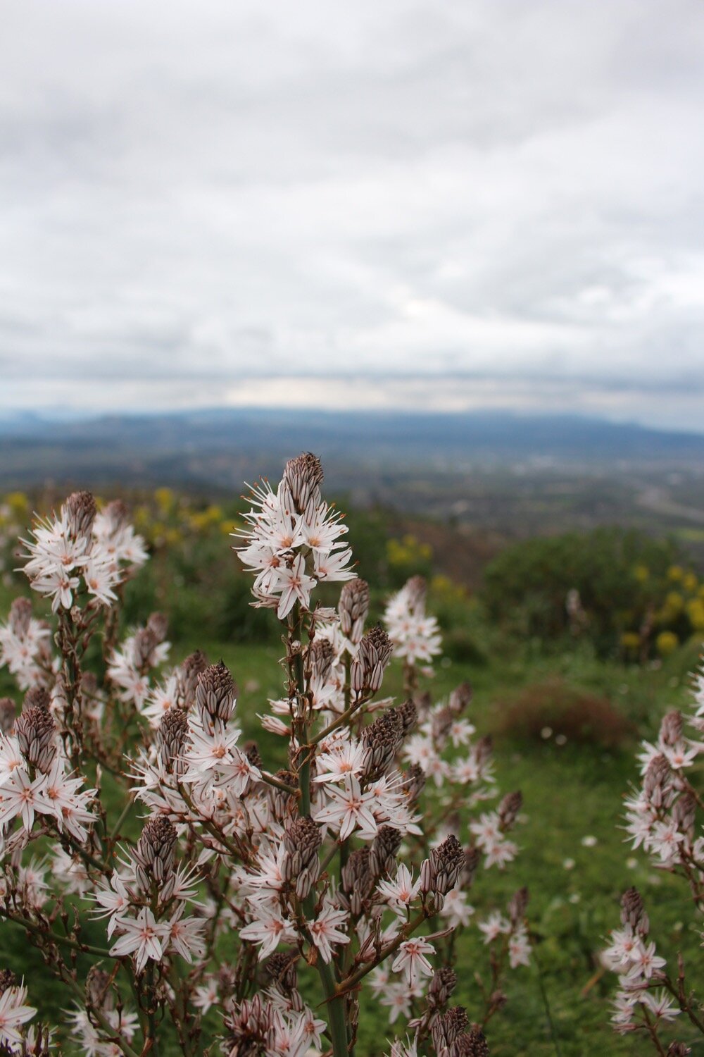
Wild mountains dominate the interior of the peninsula, while fertile plains run along the coastline and nest in the mountain valleys. The agricultural hills and plains are flush with cultivated Olive, Grapevine, Fig, and abundant Citrus, while the rest of the peninsula is graced with diverse ecosystems from marine habitats and wetlands to shrubland and alpine forests. The region is also quite tectonically active, with frequent earthquakes.
The tallest peak of the Peloponnese is Mount Taygetus (Ταΰγετος), at just over 2,405 meters (7,890 feet), followed by Hermes’ Mount Kyllini or Cyllene (Κυλλήνη) and Mount Aroania (Αροάνια), from which the Underworld river Styx has its source.
Its largest rivers are the Alfeios River (Αλφειός), which originates in the Taygetus and has been hydroelectrically dammed near Olympia (the Flokas Dam) before flowing into the Ionian Sea in the west; the Evrotas River (Ευρώτας) which flows through Sparta and the Laconia region into the Mediterranean sea in the south; and the Pineios River (Πηνειός) which begins on Mount Erymanthos (Ερύμανθος) and flows into the Ioanian sea in the west.
The Regions of the Peloponnese
Today, the peninsula is divided into seven regions: Achaea, Arcadia, Argolis, Corinthia, Elias, Laconia, and Messenia.
Achaea (Αχαϊα)
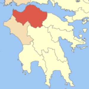
Achaea lies in the northwest Peloponnese. As host to Patras, the third largest city in Greece, the region is a central hub for commerce and travel. It is connected to mainland Greece via the Rio–Antirrio Bridge just outside Patras. Frequent ferries also connect Patras to national and international ports. The region’s largest mountain range, the Panachaiko (Παναχαϊκό), contains biodiverse forests and shrubland, but despite being a NATURA 2000 protected area, has been heavily impacted by deforestation, overgrazing by herd animals, and an extensive wind farm. In ancient times, the southeastern part of this region was included in Arcadia; it is the location of the story of Syrinx and Pan, and also hosts the source of the Underworld river Styx. As of May 2026, I have visited Patras on one occasion, and have driven the highway along the northern coast, but otherwise have yet to explore this area.
Arcadia (Αρκαδια)
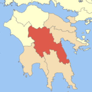
Arcadia is a central, rural region of the Peloponnese, home of the rustic god, Pan. Part of modern-day Achaea was once included in ancient Arcadia. The region’s capital, Tripoli, is a small, but underrated city in the Peloponnese. I stayed in the city after a flash flood destroyed part of the highway and forced us to take a detour; I was pleasantly surprised by its large square, garden, and historic train station. The ancient region of Arcadia is slightly larger than its modern borders, but was home to one of the most ancient tribes of Greece (possibly with roots connected to the pre-Greek, indigenous peoples of the region). Because of its wild beauty and geographic isolation, the area remained relatively pastoral throughout history and became a romantacized idyll in the western European imagination. Since the Renaissance, “Arcadia” is often used to describe an unspoiled paradise in popular culture.
Argolis (Αργολιδα)
Argolis or Argolida is a northeastern peninsula of the Peloponnese bordering the Saronic gulf. The capital of the region is the historic (though very touristic and, in my opinion, a bit overrated) Nafplio (Ναύπλιο), although the city’s castle affords gorgeous views. The region as a whole contains some of the most well-known archaeological sites of Greece, with some settlements dating to Neolithic times, including Mycenae, Argos, Troezen, and Tiryns. Argolis also hosts one of my favorite sacred sites of the ancient Greek world: Epidaurus (Ἐπίδαυρος), the dream-healing center of the god Asclepius. (Learn more about Epidaurus in the podcast episode, Hypnos and the Poppy: Ancient Greek Dream Incubation.)


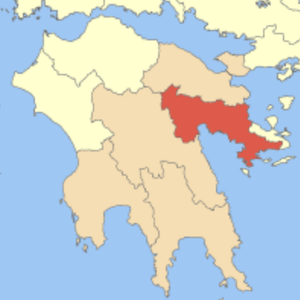
Corinthia (Κορινθια)
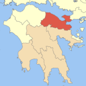
The region of Corinthia is the gateway to the Peloponnese, connected to mainland Greece by the Isthmus of Corinth and bordered to the north by the Corinthian sea. It is probably no surprise that the ancient site of Corinth (Κόρινθος) can be found here, along with its acropolis fortress, Acrocorinth (Ακροκόρινθος), with stunning views across the sea toward Delphi (in Sterea Ellada). The tallest peak of the region is Mount Cyllene (Κυλλήνη), the birthplace of the god Hermes (in ancient times, the mountain belonged to the region of Arcadia). In my opinion, the Corinthian Mountains also hide some of the most beautiful secrets of the Peloponnese, including the goddess Artemis’ Lake Stymphalia (Λίμνη Στυμφαλία), modern-day Lake Doxa (Λίμνη Δόξα), the cliff-side church of Our Lady of the Shelters, and more.


EliAs (Ηλεια)
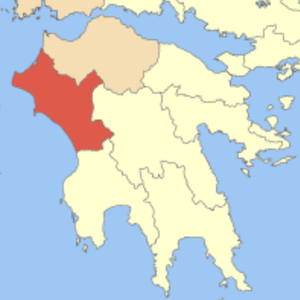
Elias, also called Elis or Ilia, is a region on the western coast of the Peloponnese. The region hosts two of the largest rivers of the peninsula: the Alpheios (Αλφειός) and Pineios (Πηνειός). The majority of the region is mountainous and forested, but most well-known for the ancient Greek site of Olympia, birthplace of the Olympic Games. I have not yet explored this area.
Laconia (Λακωνια)
Laconia is a region in the southeastern Peloponnese including the city of Sparta (Σπάρτη), Cape Malias (Καβομαλιάς), and most of the Mani peninsula (Μάνη). The region’s greatest river is the Evrotas (Ευρώτας) and boasts the largest mountain of the Peloponnese: the mighty Mount Taygetos (Ταΰγετος). My aunt has lived in Sparti for all of my life, so I’ve visited the region on numerous occasions. Some of my personal favorites include the Byzantine fortified complex of Mystras (Μυστράς); the medieval, car-free town of Monemvasia (Μονεμβασιά); and the wild, herb-filled villages of the Taygetos mountains. The small island Elafonisos (Ελαφόνησος) and the Caves of Diros (Σπήλαια Διρού) are favorites among nature-lovers, though I’ve yet to visit them.


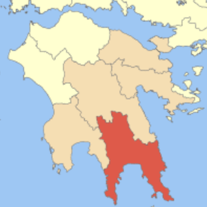
Messinia (Μεσσηνια)
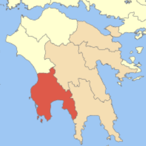
Messinia is the southwestern region of the Peloponnese and most famous for its fruit: the Kalamata Olive. There are many notable archaeological sites of the area, including ancient Messini (or Messene) and the Venetian ruins of Kalamata and Pylos. This region is also the home of my ancestors, who were Olive farmers in a small village just north of the region’s capital, Kalamata. A few of my favorite spots of this region are the small town of Kyparissia (Κυπαρισσία), including its castle and The Old Watermill (Ο Παλιός Νερόμυλος); the lovely beaches near Foinikounta (Φοινικούντα); and the wild Polylimnio Waterfalls (Καταρράκτες Πολυλίμνιο).