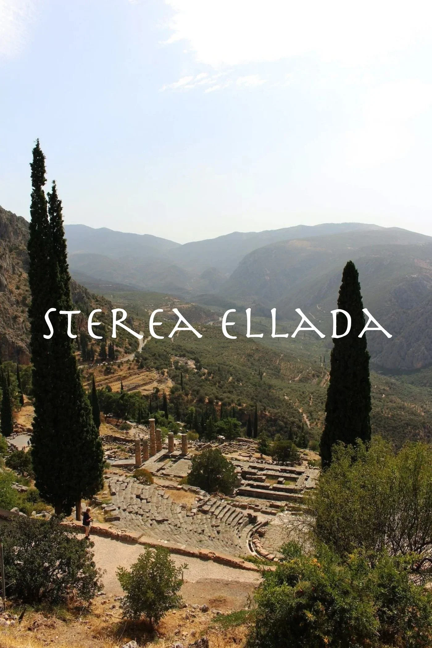
Sterea Ellada
Also known as Central Greece, Sterea Ellada (Στερεά Ελλάδα) is home to some of the most well-known temples and sites of ancient Greece, including the ancient oracle of Delphi, Trophonios, Thebes, and Thermopylae. Several myths and ancient Greek stories originate or take place in the region, including the myth of Narcissus and Echo, the story of Dionysos and Semele, the birth of Heracles, and more.

Sterea Ellada is one of the greenest regions of the country, with two national parks covering an area of over 21,000 hectares. It holds the largest natural lake in Greece, Lake Trichonida (Λίμνη Τριχωνίδα), and several mountain ranges, including Mount Giona (2510m), Vardousia (2495m), Parnassos (2457m), Tymfristos (2315m), and Oeta (2152m).
Sterea Ellada includes the districts of Boeotia, Phokis/Phokida, Phthiotis, Evrytania, and Aetolia-Acarnania.
Boeotia (Βοιωτία)

Stretching between the Gulf of Corinth in the southwest and the Gulf of Evia in the northeast, Boeotia (Βοιωτία) is one of the most fertile of Greece.
The Boeotian Kifisos River (Βοιωτικός Κηφισός) flows through its center and is the longest river of the region. Starting on Mount Parnassos, the river once fed the great Lake Kopais (Κωπαΐς) in the north of the region. The lake was one of the largest in the country, but in the late 19th century, the lake was drained to create a fertile valley used today for crops and grazing. The river was diverted to empty into Lake Yliki (Υλίκη) instead, just north of the city of Thebes. The main mountains of the region include: Parnitha (1413m) to the east, Kithaeron (1409m) to the south, Helicon (1739m) to the southwest, and Parnassos (2457m) to the west.
Bauxite is mined from the Parnassos range and used in the production of aluminum. The main crops of the region are Wheat, Olives, Grapes, Corn, and Tobacco.

A map of the landmarks of ancient Boeotia, including the now-dry Lake Copais
Some of the early Greek myths either take place or originate in this area, including the story of Narcissus and Echo, Dionysos and Semele, the birth of Heracles, and more. The region is also home to many important cities, ancient temples, and sacred sites, including:
Livadeia: The Oracle of Trophonios
Aulis: Temple to Artemis; location of the sacrifice of Iphigeneia by Agamemmnon and the departure for Troy
Orchomenos: Neolithic settlement and Mycenean capital
Glas: Mycenaean fortress
Thebes: Mycenean center and capital of the region in antiquity
Boeotia’s ancient boundaries roughly match today’s modern regional unit of the same name. Today, Livadeia (Λιβαδειά) is the modern capital of the district and its bordering regions are: Attica (to the southeast), Phokis/Phokida (to the west), Fthiotis (to the north), and the island of Evia (to the northeast).
Phokis or Phokida (Φώκις)

Just north of the Gulf of Corinth, this mountainous region is home to several mountain ranges, including Mount Giona (2510m), Mount Vardousia (2495m), Mount Parnassos (2457m), and Mount Oeta (2152m).
Bauxite is mined from the Parnassos mountain range and used in the production of aluminum. The flatter regions along the Gulf are dense with Olive trees, and Grapes and Wheat are common crops of the fertile plain. The Mornos River, which runs from Mount Oeta and feeds into the Gulf of Corinth, was dammed in the 1960s and 70s, creating a reservoir for the region.
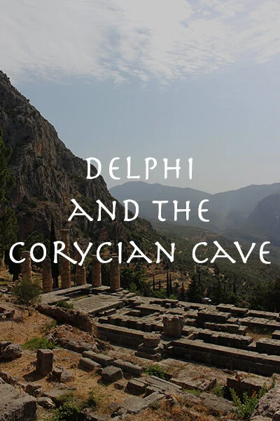
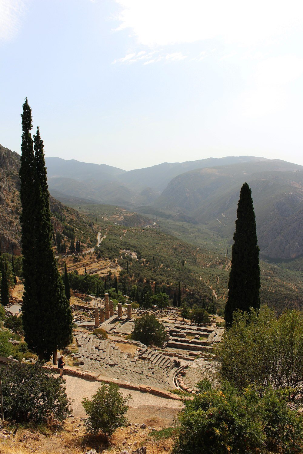
The region is home to one of the most important sacred centers of the ancient Greek world: Delphi and its oracle, the Pythia. (Read more here about the Oracle of Delphi and the sacred Corycian Cave.)
Phokis’s ancient boundaries roughly match today’s modern regional unit, now called Phokida (Φωκίδα). Amfissa (Άμφισσα) is the modern capital of the district and its bordering regions are: Boeotia (in the east), Aetolia-Acarnania (in the west), and Phthiotis (in the north), as well as a very small border with Evrytania (in the northwest).
Click the play button to interact with the map